
Lymm Dam, Risley Moss, Spud Wood and Moore Nature Reserve lead 12 walks near Warrington, with distances, start points, parking, toilets and dog rules.
The walks near Warrington most people look for are Lymm Dam, a lake and woodland circuit of about a mile and a half; Risley Moss, the peat bog nature reserve in Birchwood with its own visitor centre; Spud Wood and the Bridgewater Canal from Lymm village; and Moore Nature Reserve, reached along the old canal from Chester Road. Every entry checked against the council’s, the landowner’s or the charity’s own pages on 26 October 2026.
We have not walked these routes for this guide and nothing here is a rating. Distances, start points, parking and rules come from the people who publish the routes: Warrington Borough Council’s self-guided walks, which come with printable maps, its parks pages, Lymm Parish Council, the Woodland Trust, the National Trust and Walton Hall and Gardens. Where a source did not say whether there are toilets or stiles, we have not guessed. Paths across the borough can be muddy after rain, and tidal flooding at Arpley and Chester Road this week is a reminder to check the flood warning before a riverside walk.
Lymm and the Bridgewater Canal
Lymm Dam, Lymm
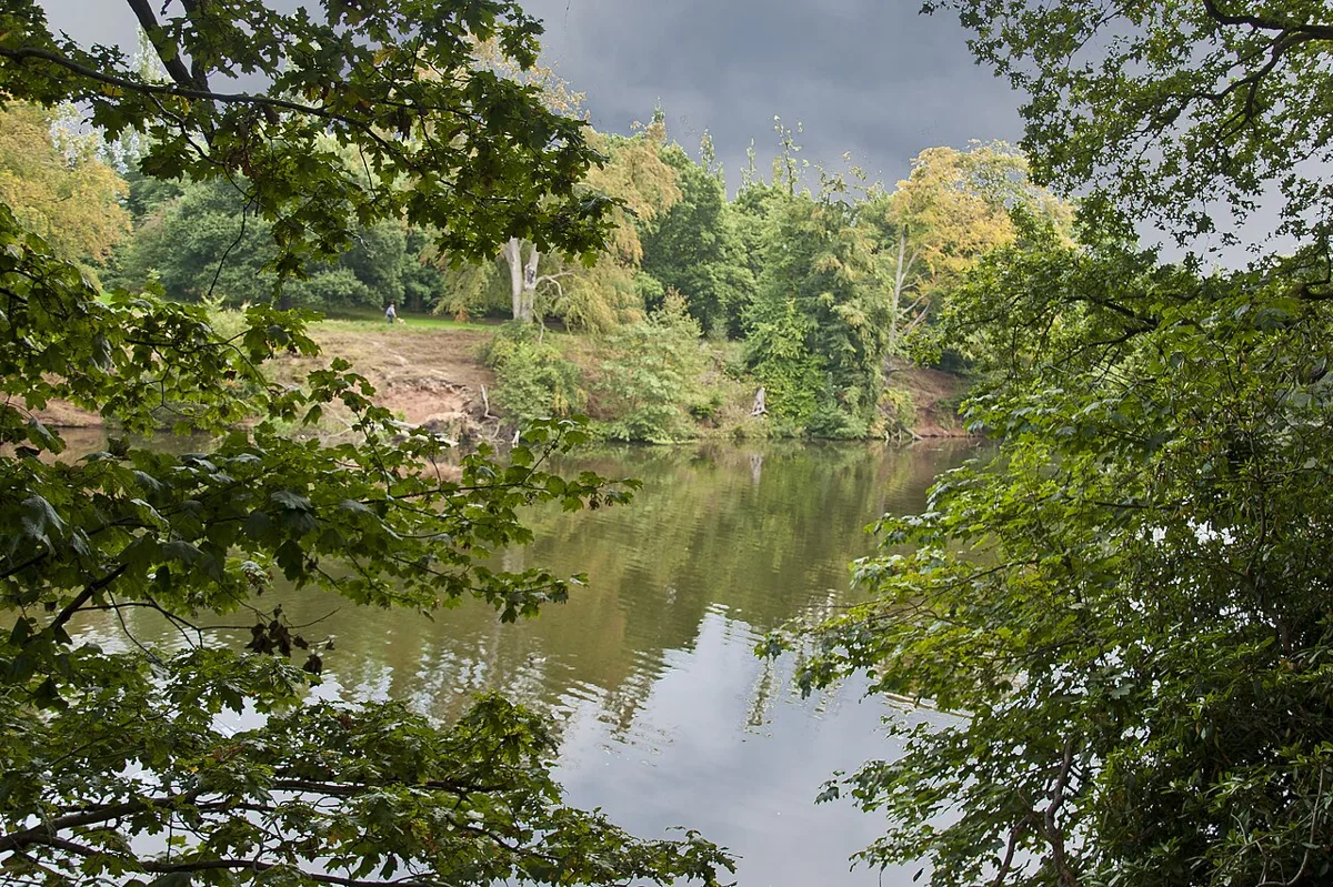
A lake made in 1824, when the turnpike road that is now the A56 was built across the valley on a dam, after villagers objected to a route through the centre, according to its Wikipedia entry; the dam and Crosfield Bridge at the head of the lake are both Grade II listed. The council’s Lymm Dam page lists woodland walks, a bridleway, picnic benches, free car parking and a link to the Trans Pennine Trail, open 24 hours a day. Lymm Parish Council’s “Two Wishes” figure-of-eight walk is about 1.5 miles (2.6km) from St Mary’s Church Hall car park on Crouchley Lane, WA13 0AS, and warns of some steps, narrow paths and mud after rain. No toilets at the dam: the Woodland Trust points to public toilets in Lymm by the post office on West Street and in the Town Trust car park next to St Mary’s Church.
Spud Wood from Pepper Street, Lymm
A council route of 4.06km (2.5 miles), about 50 minutes, from the Pepper Street pay and display car park in Lymm village. The council says it is mainly flat on roads, stone paths and mown grass, with one short, steep path from Grantham’s Bridge down to the canal, and no stiles. It loops through the Woodland Trust’s Spud Wood, 17 hectares planted in the late 1990s on a former potato field, hence the name, and back along the Bridgewater Canal towpath under Lloyd Bridge to Lymm Bridge and the Bull’s Head. The Trust lists kingfishers by the canal and a free car park for 10 cars on Stage Lane if you start at the wood instead. Buses 5 and 5A stop at Lymm Cross.
Oughtrington, Agden and the Bridgewater Canal
The longest of the council’s self-guided routes: 6.83km (4.25 miles), about an hour and 20 minutes, starting on Oughtrington Lane near St Peter’s Church. The council describes roads, stone paths and grass paths that can be muddy, no big hills, and stiles you may need to climb. The route crosses fields to Agden, passes the Wheatsheaf pub on the A56, and comes back along 1.32 miles of Bridgewater Canal towpath from Agden Bridge to Lloyd Bridge. Parking is on Oughtrington Lane, which the council asks walkers to avoid during church services and the school run, or at Agden Bridge, away from the passing place.
Birchwood, Culcheth and Rixton
Risley Moss Local Nature Reserve, Birchwood
One of the last fragments of the raised peat bogs that once covered south Lancashire and north Cheshire, 85 hectares and a Site of Special Scientific Interest, says its Wikipedia entry. The council’s reserve page lists bird hides, a woodland walk, sculptures, picnic benches, a visitor centre with toilets, and a car park. The nature trails page adds an orienteering course, a wildlife trail and the Boggarts and Friends trail of chainsaw sculptures, with maps from the visitor centre. Open Monday to Thursday 9am to 5pm, weekends 9am to 5pm from October to March; closed on Fridays. Dogs on a lead. Ordnance Avenue, WA3 6QX. Next door, Birchwood Forest Park has woodland walks over the grassed mounds of the wartime ROF Risley munitions factory.
Blakeley Farm and Culcheth Linear Park
The council’s shortest published route: 2km (1.2 miles), about 30 minutes, from the Culcheth Linear Park car park. The route notes take you up steps to the road, along farm tracks and field edges to Blakeley Farm, over a stile and back along a permissive bridleway through the park. Buses 19 and 28 between Warrington and Leigh stop at the Wigshaw Lane entrance. The council’s park page lists woodland walks linking into the local path network, benches and parking, and says the Friends of Culcheth Linear Park run a programme of organised walks and nature events, posted on their Facebook page.
Rixton Clay Pits Local Nature Reserve, Rixton
Clay was dug here for the next-door brickworks from the 1920s until 1965, and the pits have since gone back to ponds, scrub, woodland and grassland, says its Wikipedia entry, which records the largest breeding population of great crested newts in Cheshire. The council’s reserve page lists woodland and meadow walks and viewing points, open 24 hours a day, but says the visitor centre, toilets and car park depend on staff being there. Dogs must be on a lead, kept out of the ponds and away from the grazing sheep. Near Hollins Green, WA3.
Town, Woolston and the south
Walton Hall and Gardens, Higher Walton
The council-run estate south of the Ship Canal, which describes its grounds as “peaceful woodland and orchard walks” in acres of parkland and historic gardens. Its visitor page says the park is free to enter with no booking, and dog-friendly everywhere except the children’s zoo. The pay and display car park is open 8am to 6pm from September to March: £4 Monday to Friday, £5 at weekends and bank holidays, three hours free with a blue badge. Accessible toilets and baby change are spread across the estate. The Heritage Cafe in the Stables, also dog friendly, opens 9am to 4pm daily. Walton Lea Road, WA4 6SN.
Moore Nature Reserve from Chester Road
A council route of 2.84km (1.75 miles), about an hour, from Taylor Street or Chester Road, along the Trans Pennine Trail on the Old Quay Canal towpath, under two railway bridges and out along the grassy former towpath of the Runcorn and Latchford Canal. The council asks walkers to park considerately in Taylor Street and to watch for vehicles on Eastford Road. The reserve itself covers 200 acres of lakes, woodland and meadow beside the Manchester Ship Canal, run by FCC Environment, operator of the neighbouring Arpley landfill, and has bird hides, according to its Wikipedia entry. Buses 11, 12 and X30 stop at Gainsborough Road.
The Trans Pennine Trail through Warrington
The coast-to-coast trail for walkers, cyclists and, in parts, horse riders runs for several miles across the borough from Penketh to Lymm, the council’s walking page says, so it can be walked in short stretches between bus stops. The council’s trail page lists recent upgrades: the stretch between Wilderspool Causeway and Greenall’s Avenue was widened to up to 3.5 metres in May 2023 on a surface made from more than 3,000 recycled tyres, and two Lymm sections, Whitbarrow Road to Reddish Crescent and the ranger cabin to the Camsley Lane subway, were resurfaced for wheelchairs, mobility scooters and bikes in 2022 and 2023. Route maps are on the Trans Pennine Trail site.
Sankey Valley Park and the Sankey Canal
The green corridor along the Sankey Canal, which opened in 1757 and is described by its Wikipedia entry as England’s first canal of the Industrial Revolution. The council’s park page lists path networks and links, the non-navigable canal, play areas, sculptures, picnic benches and car parking, open 24 hours a day. The council’s walking page points to the Sankey Canal trail, which follows the old canal from Widnes to St Helens through Warrington, mostly through countryside and parkland with plenty of industrial history; the Canal and River Trust has the route.
Woolston Park and the New Cut Heritage Trail
Woolston Park’s council page lists woodland walks, wetlands, grassland, water features, play areas and a car park, open 24 hours a day. It sits on the council’s New Cut Heritage and Ecology Trail, a linear footpath from Paddington Bank off Kingsway to Weir Lane in Woolston, taking in Paddington Meadows nature reserve, Larkfield Park and Grey Mist Mere, with links on to Victoria Park, Black Bear Park and the Twiggeries. The council does not list toilets on the trail. The neighbouring Woolston Eyes reserve is open by permit only.
Further afield
Dunham Massey, near Altrincham
The National Trust estate just over the Trafford border, east of Lymm, with a 300-acre deer park, ancient trees and fallow deer, and accessible paths through the parkland, according to the Trust. Unlike the rest of this list it charges: the Park and Garden ticket, which includes the car park, cafe and toilets, is £11 for an adult, £5.50 for a child and £27.50 for a family of two adults and up to three children; National Trust members go free and no booking is needed. The park opens 9am to 5pm until 1 November and 9am to 4pm from 2 November, last entry 45 minutes before closing. It reopened on 26 October after a closure for high winds, so check the Trust’s page after a storm. Woodhouse Lane, WA14 4SJ.
How we chose
These are the walks Warrington people search for: the council’s four published self-guided routes, the borough’s nature reserves and country parks, the long-distance trails that cross the town, and Dunham Massey, the nearest big estate. The facts come from Warrington Borough Council’s walking and parks pages, Lymm Parish Council, the Woodland Trust, the National Trust and Walton Hall and Gardens, with Wikipedia used for history and named where it is the source. Where a source did not say whether there are toilets, stiles or parking, we have left it out. Run a reserve, lead a walking group, or spot something that has changed? Email newsdesk@warringtonwire.co.uk.
For more ideas, see things to do in Warrington, October half term in Warrington, what’s on in Warrington this month, our guides to Warrington playgrounds, pubs, cafes, Sunday roasts and restaurants, or find a cafe for after the walk in our Warrington business directory.
Frequently asked questions
What is the best short circular walk near Warrington?
Lymm Dam is the one most people know: Lymm Parish Council’s figure-of-eight route around the lake is about 1.5 miles (2.6km) from St Mary’s Church Hall car park on Crouchley Lane, WA13 0AS, with some steps and narrow paths. Warrington Borough Council’s shortest published route is the 2km Blakeley Farm and Culcheth Linear Park loop, which takes about 30 minutes.
Can I take my dog on walks around Warrington?
Yes, with rules. Warrington’s dog control order means dogs must be on a lead at the council’s nature reserves, including Risley Moss and Rixton Clay Pits, and must not go into ponds; at Rixton they must not disturb the grazing sheep. Walton Hall and Gardens welcomes dogs everywhere except the children’s zoo, and the National Trust lists dog walking at Dunham Massey.
Which Warrington walks have toilets and a cafe?
Walton Hall and Gardens has toilets across the estate and the Heritage Cafe, open 9am to 4pm. Dunham Massey has a cafe and toilets inside the paid Park and Garden ticket. Risley Moss has toilets at its visitor centre, which is closed on Fridays. Lymm Dam has no toilets of its own; the nearest are in Lymm village.
Have your say